

Known for its exuberant beauty, the island of São Miguel hides many natural secrets that have not yet been altered by man, so on your visit, you cannot miss exploring this beautiful island through its trails, which almost always have a “surprise” at the end – a magnificent landscape that will certainly leave a mark.
Salto do Cabrito

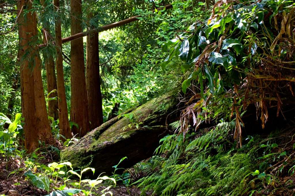
Located in the municipality of Ribeira Grande, Salto do Cabrito is one of those places that offers a fantastic landscape and its waterfall is really one of the best kept secrets on the Island, and it may be accessed on foot or by car.
Salto do Cabrito trail starts next to the Caldeiras da Ribeira Grande and takes about three hours to complete.
The whole path is surrounded by nature, passing through Fajã do Redondo and several natural boilers. However, for those who have greater difficulties, it is recommended to go by car, as the path has very steep climbs and descents.
Upon reaching the waterfall, you can climb a staircase and see a beautiful panoramic view of this stunning waterfall, but, if you prefer, you can simply take a refreshing bath in it´s natural pool. Be advised that the water is a bit cold.
Praia da Viola

This walking trail starts in the parish of Maia, in the municipality of Ribeira Grande.
Starting in Porto Novo, a small bay developing along the coast towards the parish of Lomba da Maia.
After a walk, you will arrive at a set of “tanks”, used in the past by local women to wash clothes.
Along the descent towards Praia da Viola, you will observe the old watermills of Nateiro (which, with the force of the water, transformed wheat and corn into flour).
After crossing this very quiet beach, you will reach the mouth of Ribeira do Salto, where it is possible to contemplate a nice waterfall.
Upon climbing the stairs, you will come across the ancient ruins of the Viola water mills.
The trail ends at the Church of Nossa Senhora do Rosário, in the center of Lomba da Maia parish.
This two hour trail is an easy walk.
Lagoa das Furnas

This trail starts and ends near Terra Nostra Park, one of the largest gardens in the Azores that is also quite worth visiting.
At the beginning of the trail, you will pass through the interior of the town and reach the Caldeiras area of Furnas lake, with fumaroles.
From there you can see all the exuberant beauty of Furnas lake.
Following the bank, on a dirt track, you can find some species of migratory birds, since this place is a resting ground for them. You can also visit the Furnas Monitoring & Research Center, where you will learn about what has been done to recover Furnas lake and its surroundings.
The trail continues towards the Chapel of Nossa Senhora das Vitórias. Continuing along the Estrada Regional until the entrance to Lagoa Seca, you can contemplate several volcanic deposits and Pico do Gaspar. Continue towards Lombo dos Milhos, then head to the center of the parish of Furnas, where this pedestrian trail ends.
Its a 9.2 Km trail that takes about three hours to complete, but don’t be scared since it is not difficult.
Salto do Prego/Sanguinho

Salto do Prego trail is located southwest on the island of São Miguel, in the parish of Faial da Terra. This trail is very famous amongst turists and locals since it gives the opportunity to seize an unparalleled panoramic view.
The trail takes about two hours and has 6 km, it has a medium difficulty level due to the slopes and rocks that you will find during the route.
Starting in the town, on a tarmac road, you´ll find a dirt road, with some waterfalls, streams and vegetation quite typical of the Azorean archipelago.
Surrounded by rocks, you will find the Salto do Prego waterfall which, despite its very cold water, will surely enchant you with its beauty.
This walking route also takes you to a small village, Sanguinho. It is a picturesque centenary village, which today is uninhabited but where you’ll find some typical houses and small farms. In the past, about two hundred people have lived there, who abandoned it due to lack of comfort, access difficulties and emigration. “Sanguinho” owes its name to the endemic plant in the Azores, Madeira and the Canaries.
Vigia da Baleia

This trail that connects Vila da Povoação to the parish of Faial da Terra, is accessed via the Lomba dos Pós road.
When you find a dirt path, on the right, you will go through areas with stone pavement and also through areas of Incense and Cryptomeria trees. When you turn left, you will reach Pico dos Bodes where you can see an incredible panoramic view from Faial da Terra to Vila Franca do Campo.
When returning on the same path, go down to Faial da Terra, ending the shortcut on the regional road and following a dirt path where you´ll find the old Whale Watcher.
This place was used for the observation and location of several species of cetaceans, one of the characteristics that marks the island of São Miguel. The journey lasts about three hours and is of medium difficulty.
Ribeira do Faial da Terra
This walking trail starts on the regional road between Povoação and Água Retorta, on a dirt road next to a picnic park and is along the Faial da Terra stream to it´s parish. The ground is wet and slippery specially on its wooden bridges, so be careful.
The dirt path is located parallel to the stream, through dense vegetation and passes a clearing, where there is an old watermill (currently abandoned). You will cross several wooden bridges, when turning left to Salto do Cagarrão waterfall.
By making the detour through Salto do Prego, you can explore the base of the waterfall and climb up to the top of the stream. This trail takes about two hours to complete and is of medium difficulty.
You will be able to appreciate the luxurious Cryptomeria and Incense forest as well as all the beauty and fresh air that São Miguel is known for.
Mata do Canário

This trail starts in Sete Cidades, near the “Muro das Nove Janelas” (a stone aqueduct that used to supply water to public fountains in the city of Ponta Delgada).
When moving forward on an ascending dirt path, go up the slope until you reach the first viewpoint towards Lagoas das Sete Cidades, the viewpoint of Pico da Cruz.
Continue along the dirt track and, along the ridge, you can see the interior of the caldera with lakes and various volcanic formations, as well as the entire beautiful Northwest coast of the island of São Miguel.
When you go around Lagoa Azul, you´ll go through detours to João Bom and Mosteiros, always follow the main route until you reach the junction with the Vista do Rei route. Turning left, head to Sete Cidades. This part of the trail is very slippery and sloping, so it is advisable to be careful on your descent.
This route takes about three hours and is an easy walk.
Serra Devassa

Starting on the car park opposite to the Parque Florestal da Mata do Canário, this trail allows you to walk along volcanic cones and small ponds.
When going up the slope, go around a swampy area and turn right. On this climb you will see the Lagoa do Pau Pique and the ruins of the Muro das Nove Janelas aqueduct.
As you continue, you will see Pico das Éguas, Lagoa da Égua and Lagoa Rasa, where you can go down to the lakes edge. This médium difficulty walking trail takes about two hours to complete.
Vista do Rei

Vista do Rei trail starts at the viewpoint with the same name and runs through the southwest of Sete Cidades summits, ending in the interior of this beautiful and peaceful parish.
Along the way, you´ll be able to contemplate the interior of the volcano caldera with its lakes and volcanic formations, which you will certainly not forget.
You can also take a small detour to the left, towards the Lomba do Vasco viewpoint, where you can enjoy the view over the west coast and the Mosteiros.
This trail takes about two hours, is easy and ends at São Nicolau church, in the center of Sete Cidades parish.
Chá Gorreana

This trail runs along the famous Gorreana tea plantations, and starts at the Gorreana Tea Factory.
When crossing the road to the tea crops, on the left side, you will find a dirt road with tea bushes and Cryptomeria forests.
Pass the stone bridge, where you will find some crop fields, pastures, houses to support agricultural activity and more tea plantations. You will then pass Casa do Mirante, a building that is now in ruins, but from where you can enjoy the view over the north coast of São Miguel. With a duration of about two hours, it is an easy route to take.
The trail ends again at the Tea Factory, where you can rest and learn about the tea production processe while tasting a delicious cup of Gorreana tea.
Rocha da Relva

This trail starts and ends next to the car park, used by visitors.
The descent to Rocha da Relva is made through a shortcut carved into the cliff, where you will pass through some wineries, houses and also vineyards, with the traditional basalt stone corrals that, besides offering protection from the sea, provide a more adequate environment for cultures.
This walking route will allow you to visit one of the few existing fajãs on the island of São Miguel.
When you get to sea level, take the opportunity to cool off and get some rest.
On the way back, along the descent, you will pass several houses, farms with vineyards and fruit trees. You will also find fountains and a rest area. It takes about three hours to complete and is of medium-low difficulty.
Rota da Água – Janela do Inferno

This route, which connects the parish of Remédios to the parish of Água de Pau through old paths, goes through several tunnels, so it is advisable to take a flashlight.
The trail starts next to Casa da Água, which used to be a milk station, now converted into a center for pedestrianism & environmental awareness.
When going down the path, you will reach a picnic park, then, on the left, you will find an ascending dirt path. On this climb, you will be able to see the municipalities of Lagoa and Ponta Delgada. You will reach the first tunnel and then you will pass through a house that used to support the water harvest.
As you walk along the banks of the Ribeira Seca, you will arrive at Janela do Inferno, a vertical wall with springs, where there is a cavity created by water erosion. At its base, there is a natural pond with newts.
Along the way, you will also find several aqueducts that supplied water to the old Alcohol Factory, but which now supply the municipality.
The trail lasts about two hours, is of medium difficulty, but don’t be scared, the whole landscape is quite worth it!
Vigia de São Pedro

This route connects the parishes of São Vicente Ferreira and Calhetas, along the north coast.
Starting next to Poços de São Vicente, a bathing area close to the fishing port, you will be able to see the ruins of the old Whale Factory on the other side of the road.
Follow the road until you reach a small car park and, bypassing the rooms, follow the sea along a dirt track. Follow the road to the Fenais da Luz parish and, when reaching the church of Nossa Senhora dos Aflitos, turn left, where there is a small detour to a viewpoint, in which you can enjoy the north coast of the island. Along this walk you will pass by Ponta de São Pedro, the hermitage of São Pedro and the Buraco de São Pedro, a geological formation.
This route takes about two hours and is easily accessible.
A great accommodation close to this trail is Seaside Azores Villa, located in Capelas. Click on the link to see the details of the house.
Do not forget to plan the walking trails you intend to make beforehand, wear comfortable clothes and shoes and, to avoid injuries, keep an eye on the ground.
If you´re adventurous and a nature lover, then the walking trails we presented in this article will surely meet or even surpass your expectations.